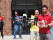
NDSCS Unmanned Aircraft Systems students participate in an NSF-funded research project

North Dakota State College of Science (NDSCS) recently collaborated with the National Center for Autonomous Technologies (NCAT) and the Colorado School of Mines to provide a group of seven students from NDSCS’s Unmanned Aircraft Systems certificate program with a unique 16-day fieldwork experience. The students traveled to Arizona and Nevada in March, where they used drones to collect data from mining sites using hyperspectral imaging, a technology that captures data from across the electromagnetic spectrum beyond the visible light our eyes can see.
The trip was funded by a National Science Foundation (NSF) grant secured by NCAT, whose mission is to educate technicians for careers in autonomous technology fields. The grant covered all travel expenses for the students and provided them with a stipend for their work.
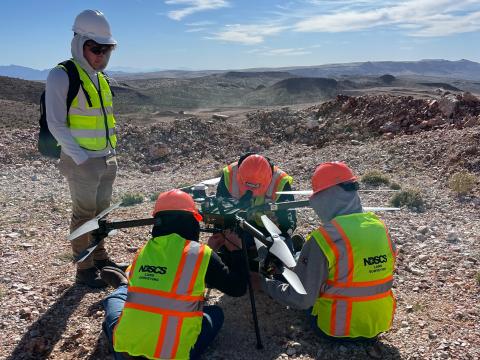
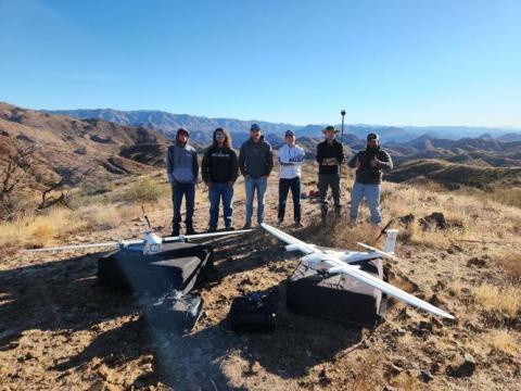
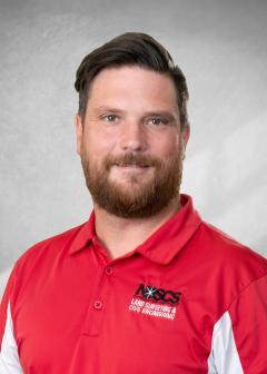
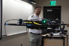
NDSCS students were responsible for planning missions, flying drones, and collecting data. Seth Simonson, NDSCS associate professor, accompanied the students and led curriculum development for the UAS component of the project. Graduate students from the Colorado School of Mines evaluated the data collected to identify and quantify material in the mines. The group from NDSCS spent eight days outside of Phoenix, Ariz., and eight days in Henderson, Nev. traveling approximately 60 miles southwest from there into California, to complete their fieldwork. The primary drone used for the project was a $70,000 quad drone equipped with a $300,000 camera that collects 490 wavelength bands. This was the NDSCS students’ first time using a camera with this level of spectral range. “Getting flight time with this high-performance camera was an incredible learning experience for the students,” said Simonson. “It sparked a lot of interest in the future of the industry.”
The NDSCS students who participated in the study included:
- Tyler Cunningham, Land Surveying and Civil Engineering Technology, Thompson, N.D.
- Annah Evavold, Architectural Modeling and Design Technology, Battle Lake, Minn.
- Bailey Goschke, Land Surveying and Civil Engineering Technology, Oslo, Minn.
- Mark Jenniges, Land Surveying and Civil Engineering Technology, Brooten, Minn.
- Joel Kavaloski, Land Surveying and Civil Engineering Technology, Lindstrom, Minn.
- Noah Cunningham, Land Surveying and Civil Engineering Technology, Minot, N.D.
- Trenton Thomasson, Land Surveying and Civil Engineering Technology, Fargo, N.D.
In addition to working with advanced technology, the students valued working in different terrain. “Around here, it’s all flat land. Out there, it’s desert and mountains,” said Mark Jenniges. “You had to pick out your vantage points. You had to figure out how you were going to plan your missions so that you didn’t wreck or lose sight of your drone because you always have to have a visual line of sight. You had to pick out take-off and landing spots–it was all very valuable experience.”
The trip also allowed students to collaborate with other professionals. “We were in the field doing a job,” said Annah Evavold. “It was our job to collect the data so the researchers could do their part in the project. We had to know what we were doing and we took it seriously.”
Joel Kavaloski said he enjoyed working with the graduate students. “The geologists explained the science behind why we were capturing the data. We knew where the drones could fly, but we didn’t necessarily know their points of interest. They helped us understand the bigger picture.”
“Overall, it was just a great work experience for us,” said Tyler Cunningham. “If future employers see that on a resume, I think they’ll take into consideration the time we spent planning missions and developing flying skills.”
This collaboration between NDSCS, the Colorado School of Mines, and NCAT demonstrates the importance of partnerships and the potential for groundbreaking research when institutions come together. Simonson looks forward to future runs of the study where he will continue to lead the UAS curriculum.
The success of this project also demonstrates how UAS is one of the fastest-growing industries with new applications constantly being identified. In response to emerging careers in unmanned aerial technologies, NDSCS is expanding its UAS certificate program into a standalone associate degree. Starting in the fall of 2023, NDSCS will offer an Associate in Applied Science degree in Unmanned Aircraft Systems with six emphasis areas including Land Surveying, Civil Engineering Technology, Architectural Modeling, Construction Inspection, Business & Marketing, and Transfer. Through a hands-on curriculum, students will learn about unmanned aircraft types, legal operational guidelines, preflight planning, piloting UAS, and collecting and processing data through photogrammetry, thermography, multispectral imaging, LiDAR, photography, and videography. Students also earn a Federal Aviation Administration (FAA) Remote Pilot Certificate preparing them to become remote pilots in different commercial environments and industries. Simonson said the FAA supports NDSCS’s expanded curriculum because of its industry focus and hands-on approach. “Students use UAS to collect and process data just as they would in industry, which distinguishes our program.”
Additional information about the NDSCS Unmanned Aircraft Systems program can be found online at NDSCS.edu/UAS.
Article written by NDSCS and submitted to external news outlets.


 The Business and Marketing emphasis area will provide students with knowledge on business and marketing practices along with communication and presentation skills.
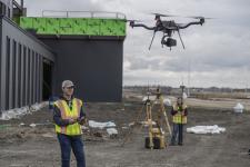 The Civil Engineering Technology Emphasis will prepare students for work as civil technicians in construction related industries with the ability to utilize drone technology.
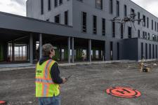 The Construction Inspection emphasis area will provide students with knowledge of construction practices, construction specifications, print reading, construction document management, material testing, and quality control practice.
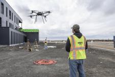 The Land Surveying Emphasis will prepare students for work as surveying technicians in construction related industries with the ability to utilize drone technology.
 With the Architectural Modeling Emphasis, in addition to the UAS courses, students will take multiple modeling courses using Autodesk Revit software. Construction methods and materials and print reading courses will also be included in the program for students to have a good knowledge of construction and ability to read prints.
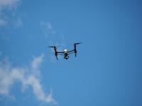 The Transfer Emphasis will provide students with a strong knowledge and skills for various applications of drone technology and compliment them with general education courses suited for transferring to a university for drone related studies.